← Peru, August 2005 · Pictures · Site map
Machu Picchu
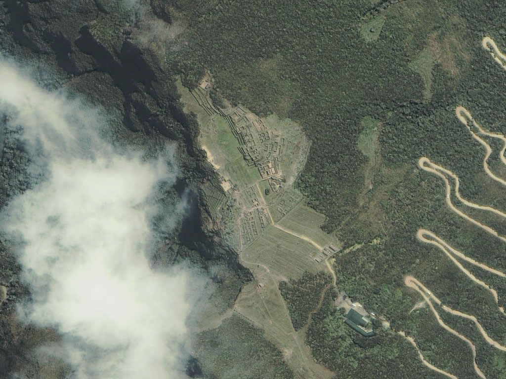
An aerial view of the city with its parts named, from the August 2005 visit.
Machu Picchu sits on a ridge 2,430 metres up between two peaks, above a loop of the Urubamba river. It was built in the mid-fifteenth century, most likely as a royal estate of the emperor Pachacuti, lived in for less than a hundred years, and left empty before the Spaniards ever reached it. Hiram Bingham was led to it in 1911. About two hundred buildings survive, in two halves, a farming half and a town half, divided by the dry moat, with the temples on the high western side and the houses on the east.
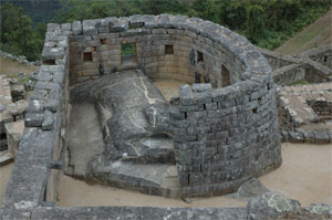
1. Temple of the Sun (Conjunto 2)
The Torreón: a semicircular tower of the finest fitted ashlar, built around a natural granite boulder that serves as its altar. A window in the curved wall lines up with the sunrise at the June solstice. Beneath it, a cave with carved steps is usually called the Royal Tomb. Called the Temple of the Sun because its curved wall is like the Temple of the Sun in Cusco, and “the most beautiful wall” in Hiram Bingham’s words.
2. Intihuatana
A pillar carved from the living rock on top of a stepped, pyramid-like outcrop, the highest point of the urban sector. The name is Quechua for the “hitching post of the sun”; its faces and edges relate to the cardinal points and to the sun’s position at the solstices and equinoxes. The Spaniards smashed every intihuatana they found in the empire. They never found this one.
3. Sacred Rock
A great flat slab of granite at the northern end of the site, set on a low plinth so that its outline repeats the profile of the mountains behind it. Two three-sided buildings face it across a small plaza. The trail to the summit of Huayna Picchu, and to the Temple of the Moon in a cave on its far side, starts here.
4. Sacred Plaza
The ceremonial heart of the city. On its north side stands the Principal Temple, three walls of huge fitted blocks around a stone altar; on the east, the Temple of the Three Windows, whose trapezoidal windows look out over the main plaza to the mountains. A smaller building on the west is known as the Priest’s House.
5. Quarry
The city was built from the granite it stands on. This jumble of boulders between the Sacred Plaza and the Temple of the Sun is where the blocks were split: some still show the rows of shallow cuts where wooden or stone wedges were driven in along a natural crack. Nice to have a source so close.
6. Eastern urban sector
The lower half of the town, across the plaza from the temples: terraces of houses, storerooms and workshops. Bingham called part of it the Industrial Sector because of the stone mortars set in the floor of one building. At its southern end is the Temple of the Condor, where a natural rock formation is completed by a carved head and ruff to make the bird.
7. Lower agricultural terraces
Andenes: stone-faced terraces stepping down the slope below the moat, each with its own fill of topsoil over gravel for drainage, and stone stairways set into the walls. Maize and potatoes grew here, though the terraces alone could not have fed the city; the great terraced hillsides of the valley below did the rest.
8. Main plaza
The long grassed plaza that divides the town in two, the temples and the elite residences on the west from the houses and workshops on the east. It was the setting for the ceremonies of the Inca calendar, and today it is where the llamas graze.
9. Dry moat
A sunken ditch, walled on both sides, that runs the width of the site and separates the agricultural terraces from the town. It is a boundary rather than a defence, and it carries away the run-off of a mountain that receives almost two metres of rain a year. Drainage is the hidden engineering of Machu Picchu: over a hundred channels run beneath the buildings and terraces.
10. Main gate
The only formal entrance to the city, a single trapezoidal doorway at the top of the terraces where the Inca Trail arrives. From inside, the door frames the peak of Huayna Picchu. A stone ring and bar-holds in the jambs show how it was closed. The Sapa Inca went this way.
11. Guardhouse and the Funerary Rock
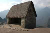
The Watchman’s Hut, a three-sided building with the view every visitor photographs, looking north across the whole city to Huayna Picchu. The grass roof is modern, but as the Inca would have done it. Beside it lies the Funerary Rock, a large carved boulder on a terrace; Bingham thought it was used in preparing the dead, and the cemetery he excavated lay on the slope below. Llamas are everywhere.
12. Trail to the guardhouse
The last stretch of the Inca Trail, coming down from Intipunku, the Sun Gate on the ridge to the south-east, where walkers on the four-day trail get their first sight of the city at dawn. Walk this way.
13. Upper agricultural terraces
The terraces above the moat and the guardhouse, climbing towards the ridge. A row of storehouses, qollqas, stands at their upper edge, built with ventilated floors to keep the harvest dry in a wet climate.
14. Hotel and entrance
The visitors’ entrance, and beside it the one hotel inside the sanctuary, the Sanctuary Lodge. You can eat here and sleep here if you are lucky enough to get a room and have about $400 a night.
15. Road from Aguas Calientes
The Hiram Bingham Highway, a dirt road of thirteen switchbacks climbing about 400 metres from the town and the railway in the valley bottom. The ride up from town takes about 20 minutes. Lots of fun when a bus is coming down around a turn as your bus is going up around the same turn.
- Temple of the Sun (Conjunto 2)
- Intihuatana
- Sacred Rock
- Sacred Plaza
- Quarry
- Eastern urban sector
- Lower agricultural terraces
- Main plaza
- Dry moat
- Main gate
- Guardhouse and the Funerary Rock
- Trail to the guardhouse
- Upper agricultural terraces
- Hotel and entrance
- Road from Aguas Calientes